


"Demonstration of surveying of the objects with GPS device"
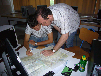
An external expert, Zlatan Soldo, BSc (Geodesy) gave a lecture to a group of students and teachers of the School of Building and Crafts of Čakovec on July 13, 2010. The objective of the lecture was to point out and explain the basic terms of geodesy and the use of GPS device in the range from maps and charts to the use of GPS for determining the coordinates of a building; The coordinates in turn provide for making drawings of objects (buildings) and other technical documentation.
Search
Calendar
| « September 2021 » | ||||||
| Mo | Tu | We | Th | Fr | Sa | Su |
| 30 | 31 | 1 | 2 | 3 | 4 | 5 |
| 6 | 7 | 8 | 9 | 10 | 11 | 12 |
| 13 | 14 | 15 | 16 | 17 | 18 | 19 |
| 20 | 21 | 22 | 23 | 24 | 25 | 26 |
| 27 | 28 | 29 | 30 | 1 | 2 | 3 |
| 4 | 5 | 6 | 7 | 8 | 9 | 10 |
View documents
Survey
Are you familiar with the roof thatching procedure?